
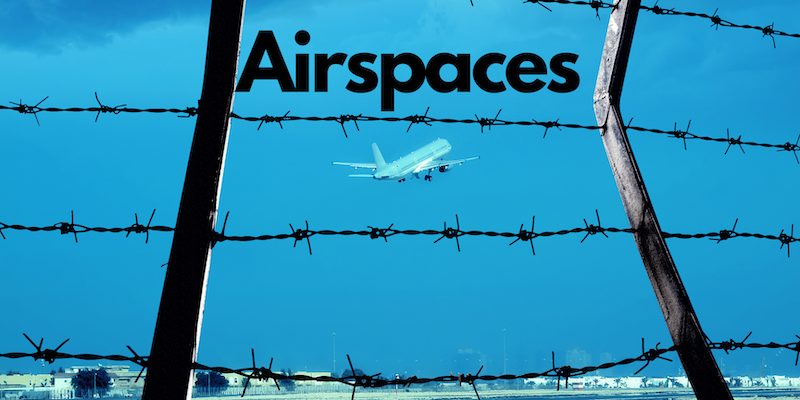
Welcome to our latest blog post where we’re zooming into the fascinating realm of aviation, particularly focusing on the diverse aspects of airspace and its classifications. As we traverse through the invisible highways in the sky, we’ll uncover the intricate structures and systematic categorizations that govern the operation of aircraft globally.
Airspace refers to the portion of the atmosphere controlled by a country above its territory, including its territorial waters or, more generally, any specific three-dimensional portion of the atmosphere. It is an invisible infrastructure that is crucial to manage because of the variety and volume of aircraft in the sky at any given time.
This post aims to enrich your understanding of how our skies are organized, highlighting the essential role of airspace classifications in ensuring safe and efficient air travel.
What is Airspace and how is it essential for pilots and aviation?
Imagine the sky as a giant invisible cake with multiple layers. Each layer or “zone” is like a road in the sky that pilots have to follow when flying their aircraft. This whole system of sky roads is what we call “airspace”. It’s super important because it helps prevent airplanes from running into each other, and ensures that they can travel efficiently to their destination.
Just like how we follow certain rules and signs on our roads and highways, pilots have to follow certain rules and signs in each zone of the airspace to safely fly their planes. Just like how you wouldn’t want cars and bicycles on the same lane, different types of aircraft are given different lanes or zones in the airspace to avoid any accidents.
Navigating in three-dimensional space can be quite challenging for pilots. Unlike on land, there are no hanging signboards in the atmosphere to guide them. There are no fixed roads in the sky, this creates the risk of aircraft flying into each other from any direction. It’s like having a blind spot, but everywhere except straight ahead. The weather can further limit visibility, making even the view in front a blind spot.
For pilots, an in-depth understanding of the different classifications of airspace is paramount. It informs them of the rules, minimum visibility, entry requirements, and the type of communication required within each class. This knowledge allows pilots to plan their flight routes effectively, ensure seamless communication with air traffic control, and ultimately, safeguard the passengers and crew onboard.
What are the classifications of airspace according to ICAO?
The International Civil Aviation Organization (ICAO), a UN specialized agency that develops international standards and regulations for aviation safety, security, efficiency, and environmental protection, classifies airspace into seven categories, labeled A through G. The following are the 7 classifications of an airspace according to ICAO:
- Class A airspace is typically the highest level of airspace where only instrument flight rules (IFR) are allowed.
- Class B airspace surrounds the world’s busiest airports and has strict control due to the volume of air traffic.
- Class C airspace is usually around smaller airports that have a moderate amount of air traffic, and a mix of IFR and visual flight rules (VFR) traffic are allowed.
- Class D airspace covers the area around smaller, local airports, with control towers, and also allows for a mix of IFR and VFR.
- Class E airspace is everything else in the controlled airspace that is not classified as A to D.
- Class F airspace is rarely used but is a hybrid of controlled and uncontrolled airspace.
- Class G airspace is uncontrolled and typically covers a small area close to the ground.
Each classification has specific requirements and rules to ensure overall air traffic safety. But every country does not use the same rules but rather builds upon these guidelines and interprets as per their individual requirements.
What are airspace categorizations in different countries?
While ICAO provides a general framework for airspace classification, the exact implementation of these guidelines varies from country to country. For instance, the United States follows the ICAO’s classification system but with some modifications, while Canada has adapted the ICAO’s classifications to better suit its expansive geographical area.
Meanwhile, some countries like Germany have their unique system, which does not strictly adhere to ICAO’s A-G classifications. Thus, while the ICAO’s categorizations form the basis for most countries’ airspace classifications, the specifics can differ according to individual country logistics and needs.
Following are the airspace classifications from different countries to help you understand how they build upon the ICAO’s classification.
Classifications of airspace in the USA
In the United States, the Federal Aviation Administration (FAA) follows the basic ICAO classification system with some adaptations. Classes A, B, C, D, E, and G are all recognized with Class F being the exception.
- Class A airspace covers the entire continental U.S. from 18,000 feet to 60,000 feet and is entirely for IFR flights.
- Class B airspace is around the busiest airports, such as Los Angeles or New York JFK, and requires an ATC clearance for all aircraft.
- Class C and D airspaces surround smaller airports with a control tower, usually those that have a reasonable number of commercial flights.
- Class E airspace is the controlled airspace not classified as A, B, C, or D, and includes routes for IFR operations.
- Class G airspace is uncontrolled and typically covers a small area close to the ground.
The FAA has also defined special use airspaces in addition to the basic A-G classification, including Military Operations Areas (MOAs), Restricted Areas (RAs), and Prohibited Areas (PAs), among others, to manage complex and varied air traffic across the country.
Classification of airspace in Canada
In Canada, airspace classifications are managed by NAV Canada and Transport Canada, and they somewhat differ from the ICAO standard. It also uses six different classifications, from A to F, each with their respective operating rules and service provisions.
- Class A airspace in Canada is all high-level controlled airspace from 18,000 feet up to and including Flight Level 600 (60,000 feet), where only IFR flights are allowed.
- Class B is controlled airspace from 12,500 feet or at and above the MEA (whichever is higher) up to but not including 18,000 feet.
- Class C airspace is generally airspace around busy airports where operational control is needed due to high traffic volume.
- Class D also covers areas around airports, but these are less busy than those covered by Class C.
- Class E is all low-level controlled airspace not classified as B, C, or D, along with specified airspace above 18,000 feet, not classified as A or B.
- Class F airspace is not controlled but may be restricted or advisory in nature.
While there are commonalities, Canada’s system reflects the unique demands of its aviation environment, which includes vast, sparsely populated regions and extensive remote wilderness areas. Check here for NavCanada’s representation of airspace in Canada and here for Transport Canada’s representations.
Classification of airspace in United Kingdom
In the United Kingdom, the classification of airspace is managed by the National Air Traffic Services (NATS) and the Civil Aviation Authority (CAA). Similar to ICAO standards, the UK also uses classifications from A to G, each with their own specific operating rules and services.
- Class A airspace encompasses all controlled airspace from Flight Level 195 to Flight Level 660 where only IFR flights are permitted.
- Class B airspace is not currently used in the UK.
- Class C airspace is found around certain main airports. Both IFR and VFR flights are permitted, but they must have an Air Traffic Control (ATC) clearance to enter.
- Class D airspace is often seen around smaller regional airports. Both IFR and VFR flights are allowed and require ATC clearance to enter.
- Class E airspace is found above Flight Level 105 up to Flight Level 195. Both IFR and VFR flights are allowed but only IFR flights require ATC clearance to enter.
- Class F airspace is not used in the UK.
- Class G airspace is uncontrolled and covers the rest of the UK airspace not classified from A to E. Both IFR and VFR flights are allowed and do not require ATC clearance.
These classifications reflect the unique requirements of the UK’s aviation environment, which includes densely populated cities, busy airports, and a multitude of smaller, local airfields.
Classification of airspace in India
In India, the classification of airspace is regulated by the Directorate General of Civil Aviation (DGCA). Analogous to other regions, India also categorizes airspace from A to G, each bearing distinct operational rules and services.
- Class A airspace is not used in India.
- Class B airspace, which engulfs all airspace from 20,000 feet up to and including 60,000 feet, allows only IFR flights.
- Class C airspace, usually in the vicinity of busy airports, permits both IFR and VFR flights. Both of these flights need to have an Air Traffic Control (ATC) clearance to enter.
- Class D airspace is typically found around smaller, regional airports and both IFR and VFR flights are allowed. They require ATC clearance to enter.
- Class E airspace is used for specified air routes within controlled airspace from 14,500 feet to up to, but not including 18,000 feet. Both IFR and VFR flights are allowed but only IFR flights need ATC clearance to enter.
- Class F airspace is for advisory routes where flight advisory service is available. Both IFR and VFR flights are allowed.
- Class G airspace is uncontrolled, covering the remainder of the Indian airspace not classified from B to F. Both IFR and VFR flights are allowed and do not require ATC clearance.
These classifications accommodate the diverse needs of India’s aviation scene, which includes bustling metropolitan cities, major airports, and numerous smaller, regional airfields.
Some other frequently asked questions about airspace in aviation:
How is airspace controlled?
Airspace is controlled through an intricate network of Air Traffic Control (ATC) systems, radar technology, and comprehensive regulations. These entities work in close collaboration to ensure the safe and efficient movement of aircraft in the sky.
The ATC systems provide pilots with real-time traffic, weather, and navigation data, and they manage the flow of aircraft in and out of airports. Radar technology plays a critical role in detecting and tracking aircraft, thereby reducing the risk of collisions.
Lastly, regulations established by aviation authorities, such as the DGCA in India, dictate operational rules for different classes of airspace, providing guidelines for flight paths, altitudes, and aircraft behaviors.
What is class Charlie airspace?
Class Charlie airspace is a controlled airspace that extends from the surface to 4,000 feet above the airport elevation, surrounding those airports which have an operational control tower, are serviced by a radar approach control, and have a certain number of IFR operations or passenger emplacements.
This airspace is designed to accommodate busy airports with significant commercial traffic. Pilots are required to establish two-way communication with ATC before entering this airspace and must adhere to specific flight direction and altitude instructions while in Class Charlie airspace.
Is airspace MSL or AGL?
Airspace is typically defined in terms of both Mean Sea Level (MSL) and Above Ground Level (AGL). MSL is a standard measurement of the altitude of an object, relative to the average sea level. On the other hand, AGL is the height of the aircraft above the underlying ground surface.
Both these units are crucial in aviation for maintaining proper aircraft separation and ensuring safe vertical clearance from the ground and other obstacles. It’s vital for pilots to understand the difference between these two measurements to ensure safe navigation and operation of the aircraft.